|
|
%20-%20Leica%20Geosystems%20-%20Leica%20Geosystems.files/pix.gif) |
| |
|
|
|
| Product Name: |
AK36R厘米级无人机盘煤仪 |
| Model: |
AK36R |
| Brand: |
BEIJING SAM SURVEYING |
| |
|
|
|
|
| Product Advantages: |
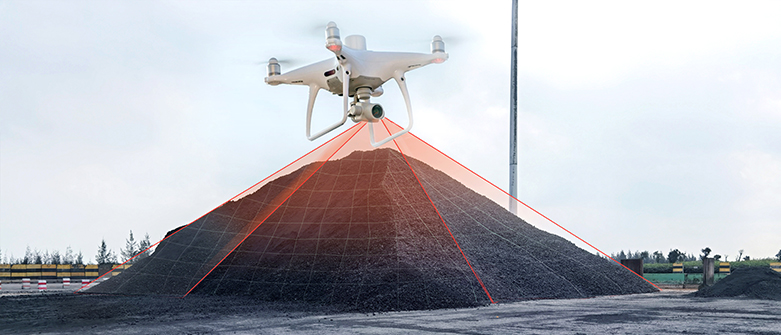
1) AK36R UAV coal panzer is a small multi-rotor high precision UAV coal panzer.
2) Integrating a new RTK module, with stronger anti-magnetic interference capability and accurate positioning ability.
3) providing real-time centimeter-level positioning data, significantly improving the accuracy of the data.
4) the system supports PPK post-processing and connection to D-RTK high-precision GNSS mobile station.
(5) Real-time differential access to high-precision data via 4G wireless network card or WiFi hotspot.
6) the equipment flight control, camera and RTK clock system microsecond synchronization, the camera imaging moment millisecond error.
7) compensation for the camera lens optical center position and RTK antenna center point position, reduce the position information and the camera time error, providing more accurate position information. |
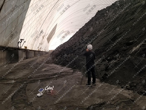
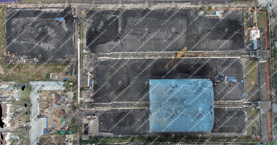
Drone air film shed in the measurement site real photo
|
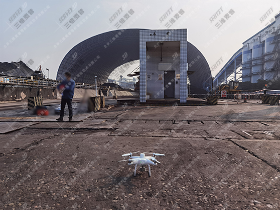
UAV measurement site real shot
|
| |
| UAV coal pan effect: |
| |
Live shooting
|
| |
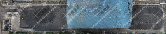
Live shooting
|
| |
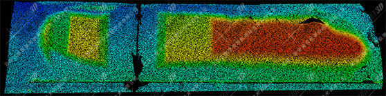
Dense point cloud
|
| |
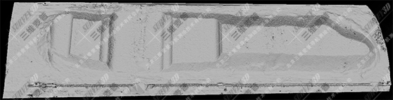
Rendering of coal yard
|
| |
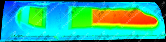
Elevation rendering effect
|
| |
| |
| Technical parameters: |
| |
|
| Product Type |
Professional-grade quadcopter |
| |
|
| Product weight |
1391g |
| |
|
| Flight radius |
0-6000m |
| |
|
| Hovering accuracy |
When RTK is enabled and RTK is working normally: vertical: ±0.1 m; horizontal: ±0.1 m |
| |
|
| Flight speed |
Positioning mode: 50km/h Attitude mode: 58km/h |
| |
|
| Wheelbase |
350mm |
| |
|
| Hover time |
About 30 minutes |
| |
|
| Withstand wind speed |
Level 6 |
| |
|
| Cloud Terrace |
3-axis head, stable accuracy ±0.02° |
| |
|
| Vision System |
Front View Vision System / Rear View Vision System / Down View Vision System |
| |
|
| Obstacle perception range |
0.7 - 30 m |
| |
|
| Camera |
Image sensor: 1-inch CMOS effective pixels: 20 million |
| |
|
| Vision sensing navigation system |
-20°C to 50°C |
| |
|
| Cloud Terrace |
3-axis head, stable accuracy ±0.02° |
| |
|
| Vision System |
Front View Vision System / Rear View Vision System / Down View Vision System |
| |
|
| Obstacle perception range |
0.7-30m |
| |
|
| Camera |
Image sensor: 1-inch CMOS effective pixels: 20 million |
| |
|
| Display devices |
| |
|
| Operating equipment |
Tablet |
| |
|
| Processing equipment |
Portable Laptop |
| |
|
| Flight Control Software |
| |
|
| Smart Navigation |
The software is easy to operate, with intelligent navigation functions, the user can follow the prompts to operate the steps |
| |
|
| Route Planning |
Automatic route planning, automatic aerial photography and return |
| |
|
| One-touch take-off and landing |
One-touch take-off and landing function |
| |
|
| Real-time monitoring |
Real-time adjustment of heading |
| |
|
| Memory Storage |
System configuration and data saving, set up once for the same site |
| |
|
| Software Features |
|
| |
|
| Memory Storage |
Software running platform Windows 7 and above |
| |
|
| Calculation accuracy |
Fully automated high-precision 3D modeling, disc coal accuracy of 99.5% or more |
| |
|
| Intelligent noise reduction |
Ability to remove invalid data from outside the coal field area, ability to calculate volume and weight |
| |
|
| Partition Calculation |
Can realize the function of unified inventory, partition calculation volume, data editing function |
| |
|
| Three-dimensional view |
Display all coal field model drawings under one interface and support 3D dynamic browsing |
| |
|
| Color rendering |
Inclined ground measurement, coal pile 3D model map can be color elevation rendering, easy datum selection |
| |
|
| Intelligent processing |
Invisible foundation surface processing function: For the situation that the foundation surface is deeply buried under the coal pile, this function can be used to automatically process and eliminate the error. |
| |
|
| Upgrade Extensions |
Software can be integrated with other laser counting devices for future upgrades and expansion to automatically generate standard format reports |
| |
|
| |